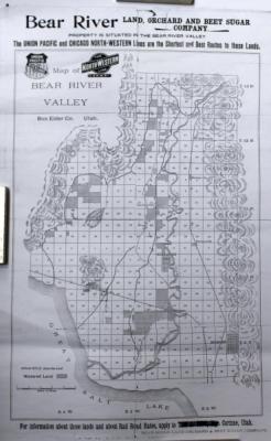
Map of Bear River Valley
Historical
Identifier:
2012.41.36Description
Black and white copy of a map by the Bear River Land, Orchard, and Beet Sugar Company. Map shows Townships 9 N, 10 N, 11 N, 12 N, and 13 N (all West), and includes topographic features, railroads, canals, rivers, etc. Towns of Brigham City, Corinne, Honeyville, Bear River City, Rowe-ville, Deweyville, Garland, Riverside, Fielding, and Plymouth are shown. Also shows an "Experimental Farm" and Fruitvale Orchard Co. near Corinne, the Fairview School, and the Central Farm in Rowe-ville. Bottom of map reads "For information about these lands and about Rail Road Rates, apply to Tom D. Pitt, Mgr., Corinne, Utah."Modern Township & Sections;http://www.geocommunicator.gov/blmMap/Map.jsp?MAP=OG.
