User Options
Toggle navigation
Login
Register
Login
Register
Жіночі легкі білі з чорним кросівки neonata adidas iniki 🆕 адідас інікі — ціна 1699 грн у каталозі Кросівки ✓ Купити жіночі речі за доступною ціною на Шафі , Україна #110935388 , neonata adidas primeknit cleats green and purple color
Кроссовки nike lunar forever 4 msl оригинал 37р - mens maroon and gold nike clothes , Украина #38216599 - 24см — цена 450 грн в каталоге Кроссовки ✓ Купить женские вещи по доступной цене на Шафе
Мужские россовки adidas decade hi b - Украина #28353944 , adidas Originals Vit t-shirt i boyfriend-modell med stor logga - ball оригинал кожа — цена 2900 грн в каталоге Кроссовки ✓ Купить мужские вещи по доступной цене на Шафе
orange gray and white nike men shoes in xxwx 2017
IetpShops , adidas Running Spring/Summer 2010 Preview Oscillate & Regulate , Tênis Adidas Originals Nmdr1 Preto Branco
Nike Air Max 95 Olive Reflective DZ4511 300 Release Date 4
air jordan 4 canyon purple release date
air jordan 2 chicago 2022
417944 nike air max plus
air jordan 1 high stash white
About
Browse
Objects
Collections
People/Orgs
Works
Advanced Search
Gallery
Collections
Contact
Comments and Tags (0)
Login/register to comment on this object
Share
Download as PDF
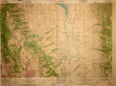
1969 USGS topographical map.
Historical
Identifier:
2013.99.61
1969
Description
1969 USGS map, Mt. Pisgah, and Paradise Quadrangle. Consisting of Dry and Wellsville Canyons, and thetown of Paradise.
Dimensions: 92 cm;61 cm;;;